


N. Michigan: St Helen, Mio, Rose City, West Brabch
 Apr 21, 2019 | 04:53 PM
#351
Country Rider
Joined: Apr 2017
Posts: 404
Likes: 0
From: Michigan

I spent half the day yesterday detailing new trail maps for upcoming trip to Baldwin....phew! I needed a good day for it, since there was nothing outside worth doing as cold/damp as it was, But I hate getting to new areas unprepared, or lost in the woods, somewhere, especially, close to dracula's waking up time, near dark! lol Been there done that, too many times....scarry!! Coyotes start howling....makes the hairs on the back of your neck stand up, and pay attention!! Here's what I have laid out so far, and hope it shows the whole map. I sent Chris a copy, but he said parts were missing.
Apr 21, 2019 | 05:38 PM
#352
Thread Starter
|
Pro Rider
Joined: May 2016
Posts: 1,148
Likes: 7
From: Taylor,Mi.
Did I do a good enough job, mapping the entire area out? Anything missing? Any thing I should add? Anyway to ride into Baldwin? I've Never ridden there, and had to study and trace the map, from other less detailed maps, after enlarging them, so I could see or catch every turn in the trail! and to have something showing elevations, swamps, roads, ect. Then added places that my friend told me about, like gas, restaurants, camps, motels etc. still working on adding more to it, with input from others, that have been there, and after I finally ride there myself! Good to hear positive things about the place, can't wait to see it for myself, this weekend!
Question? Is there a trail joining Tin cut to Manistee trail? DNR maps don't show any.
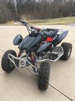
Just put the Honda TRX450r up for sale, on Craigs today. Your right about it not being the right machine for those kinds of conditions, and is why I bought the Suzuki KQ 750, with new more aggressive tires too, that should get me through most anything that comes, its way lol
Question? Is there a trail joining Tin cut to Manistee trail? DNR maps don't show any.
Just put the Honda TRX450r up for sale, on Craigs today. Your right about it not being the right machine for those kinds of conditions, and is why I bought the Suzuki KQ 750, with new more aggressive tires too, that should get me through most anything that comes, its way lol
Apr 21, 2019 | 06:31 PM
#353
Country Rider
Joined: Apr 2017
Posts: 404
Likes: 0
From: Michigan
Yeah you did a good job. The gas station is the only one in there area and connects to little maniste, hence, gets a lot of business. The only thing i dont know if you have yet that id add is where all of the parking lots are on the trails and make sure you can still see the roads on the map.
No there is not a direct trail that connects Tin Cup to little Manistee or the other tails. However, since the trails were so muddy we explored all the dirt roads in the area and ripped around. Its legal to ride all the dirt roads there and on the edge of almost all of the normal roads. We found that we could ride some of the dirt roads almost straight from little maniste to Tin cup so you could do visvera too. We markered the trail on my dads GPS but i dont remember the street names or exact path. Sorry bout that. We took the dirt roads from the second parking lot on little Maniste and it took us to the trail right next to the power lines that people ride off the Tin cup trail.
Did that help? any other questions or anything i missed to awnser?
No there is not a direct trail that connects Tin Cup to little Manistee or the other tails. However, since the trails were so muddy we explored all the dirt roads in the area and ripped around. Its legal to ride all the dirt roads there and on the edge of almost all of the normal roads. We found that we could ride some of the dirt roads almost straight from little maniste to Tin cup so you could do visvera too. We markered the trail on my dads GPS but i dont remember the street names or exact path. Sorry bout that. We took the dirt roads from the second parking lot on little Maniste and it took us to the trail right next to the power lines that people ride off the Tin cup trail.
Did that help? any other questions or anything i missed to awnser?
Apr 21, 2019 | 08:25 PM
#354
Thread Starter
|
Pro Rider
Joined: May 2016
Posts: 1,148
Likes: 7
From: Taylor,Mi.
Forgot to mention the main reason for making the map, was for having all the trails on one page, mounted on a platform, in front of me, while riding, without having to stop for very long, trying to see small details! that's why the heavy marker showing the trails, especially helpful on night rides!, The dnr maps are horrible, with there faintly micro fine trail lines, where you would need a flashlight, microscope, and a good pair of reading glasses and a great deal of patience to be able to find your way, while mr big foot is charging down the trail after you! lol
Added more details to map
Added more details to map
Apr 22, 2019 | 06:09 AM
#356
Thread Starter
|
Pro Rider
Joined: May 2016
Posts: 1,148
Likes: 7
From: Taylor,Mi.
Yeah, and I'm making the roads much larger to see too, who makes these stupid maps anyways! They make it so hard to read almost everything, what good are they unless you just happen to have a magnifying glass in your pocket at all times, for whenever you happen to look at a map! lol I had to do this same thing for Mio, St Helen, Rose City maps. I keep riding in many more places I might have the entire mapping system redone! lol
Apr 22, 2019 | 11:14 PM
#358

THE BERMINATOR


Joined: Sep 2018
Posts: 1,200
Likes: 2
From: Michigan
Sometimes I see trail maps like this one on the trail behind clear plastic, attached to a board on a post. It doesn't take long for the sun to start making them fade and eventually everything red disappears. And the red parts are all the trails and routes, so when it's marked "You Are Here" it shows what part of the woods you're in but not where the trail is or which way to go.
Apr 23, 2019 | 03:38 AM
#359
Thread Starter
|
Pro Rider
Joined: May 2016
Posts: 1,148
Likes: 7
From: Taylor,Mi.
I think they do their best to confuse us, but we pay extra now through our trail permits that are supposed to go for trail improvements, like directional trail markers, yet very little has been done in the 40 yrs of my riding. I think what the state is trying to do is make us beg for these improvements, so they can up the cost for permits even higher!

